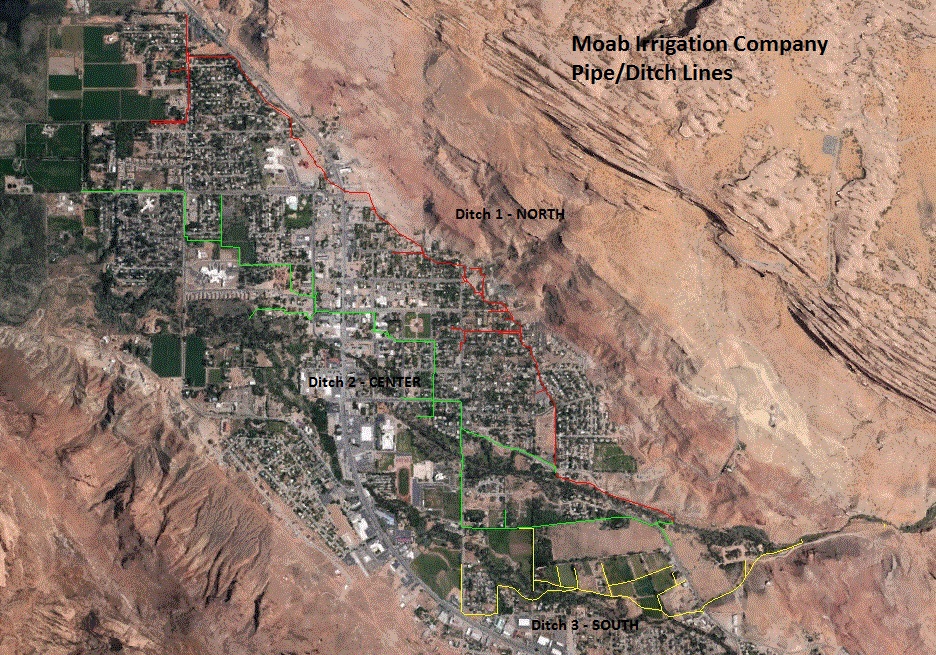
Moab Irrigation Pipelines
Moab Irrigation Company has three major pipelines in the lower Moab valley. The pipelines run where the historical ditches use to flow. Some line are not actually underground pipelines, but may be surface ditches.
Please Note - not all pipelines shown are company owned. Many share holders have private lines that feed off of the main company lines. Where private lines are known, they are shown on the maps. Other private lines may exist that are not shown. Map locations of the pipelines are approximate. Actual line location could be many feet away on either side of the point shown on these maps. If you need to find a company line, please call Blue Stakes.
To view the line locations, download the zip file. Inside are three Google Earth KML files. Run Google Earth and open up the KML files.
